Aerosol-Cloud Interactions and Precipitation in the Aral Sea basin
MODIS
Clouds
Precipitaion
R
Analysis of cloud-aersol interactions in the Aral Sea basin.
What is it about?
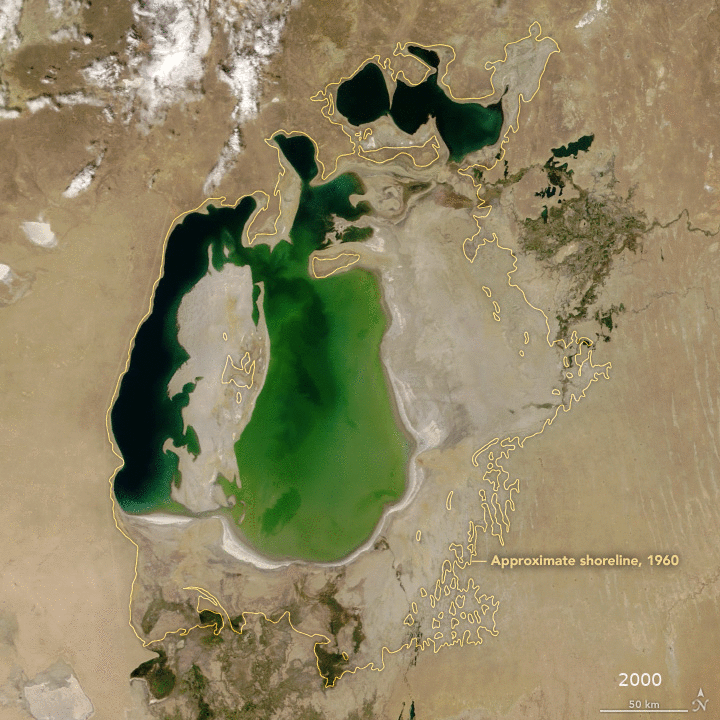
Once the largest terminal lake in Central Asia, the Aral Sea is fed by its tributaries, the Syr Darya and the Amu Darya. It has suffered from a significant reduction of water inflow during the last two decades. Consequently, the water retreated from large portions of the former sea’s surface, forming a dessert called Aralkum. The diffusion of dust and sand particles in the area may threaten human health and agricultural productivity. Also, concerns about impacts to the regional hydrological cycle through the increase of aerosols in the atmosphere have been raised.
(Source: NASA 2019)
The interaction of aerosols with cloud micro-physics is very complex and one of the mechanisms in our atmosphere, we barely understand (Boucher et al. 2013). Besides, our understanding of the process is subject to inaccuracies due to limited observational capacity. For example, from passive optical instruments aboard satellites, it is only possible to retrieve information on aerosols when clear-sky conditions are met. Evidently, the opposite is valid for cloud parameters, rendering every analysis to significant differences at the time scale between the measured properties of clouds and aerosols. Additionally, the parameters which are derived are generalized for the vertical atmospheric column for every spatial unit, meaning we do not get any information about the vertical distribution of neither aerosols nor clouds.
What it can do!
The mechanisms which govern the cloud-aerosol interactions mainly depend on the type of aerosol, whether it acts hydrophilic or hydrophobic, and its size. Some mechanisms are expected to suppress precipitation, while others are suspected of leading to more severe and intense precipitation events. To investigate the relationship between aerosols and precipitation, I made use of the MODIS cloud and aerosol products as well as the CHIRPS data set.
The former uses satellite and ground observations to retrieve rainfall rates at a monthly resolution. The cloud and aerosol parameters were aggregated to the same spatial and temporal resolution to allow a correlation analysis.
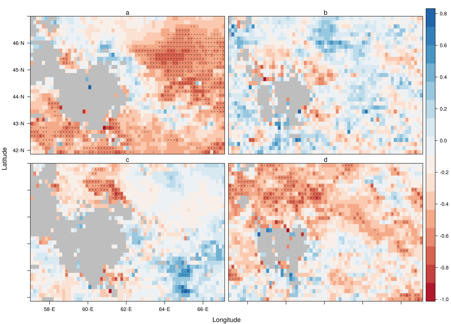
During spring (a) and winter (d), a negative relationship between the Aerosol Optical Depth (AOD) and precipitation rates (P) govern the study area. During the other two seasons, we also see pixels with positive correlations. However, these are not significant (pixels with a significant correlation are marked by crosses). The analysis was done in R and included data from 2003 to 2018 because since then, both MODIS satellites delivered observations for the study area. The source code of the complete project can be found in a GitHub repository, along with a more comprehensive discussion of the results.