Tree species classification based on UAV orthoimages
What is it about?
Supervised machine learning algorithms can help to extract useful information from high-dimensional datasets to benefit environmental conversation efforts. The correct identification of tree species based on imagery collected by low-cost UAVs and conventional cameras is undoubtedly a promising advancement in technology which might reduce the cost of local forest monitoring. Because the broader use of this technology only occurred very recently, structural investigations into the benefits and the limitations of this approach are limited. As a student’s team, we set out to investigate the relationship between the classification accuracy and different spatial resolutions of the imagery. Additionally, we were interested in the question of whether or not predictor variables calculated based on multi-temporal observations throughout the growing season enhances the classification.
What can it do?
We established an empirical experiment to investigate the influence of spatial resolution and mono- vs. multi-temporal predictor variables using the Random Forest algorithm. We used 5-fold cross-validation combined with the Leave-Location-Out approach (LLOCV) to train a total number of 9 models. These included each combination of three different spatial resolutions (10, 15, and 25 cm) and three different combinations of the predictor variables (mono-temporal, seasonal, and both predictor sets.)
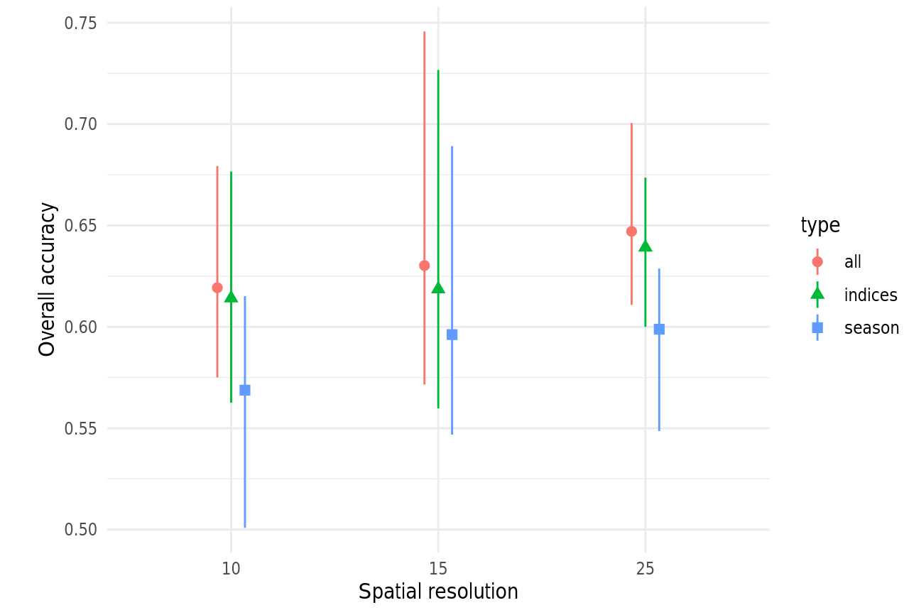
We learned that a medium resolutions seems beneficial and that seasonal parameters are able to increase the classification accuracy at about 1-2 %. There were also indications, that object-based classification has the potential to significantly increase the overall accuracy.
Interested in the results? Check out our written report or browse through our R code workflow.